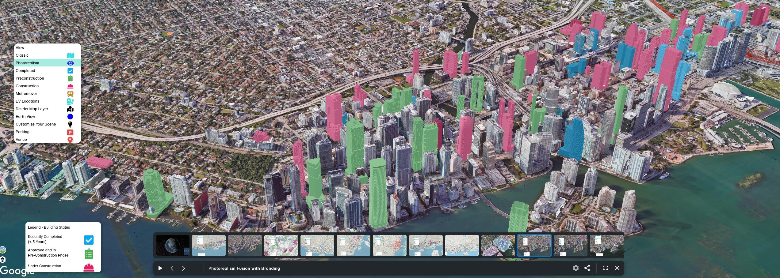
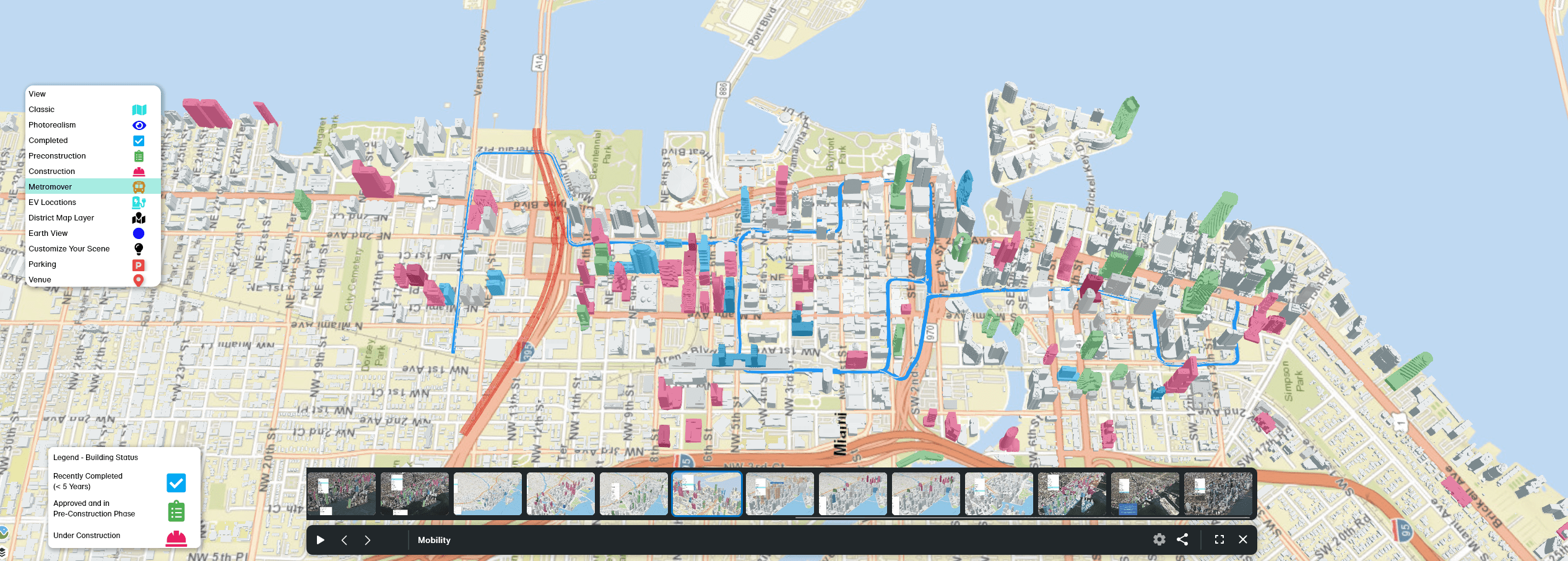
Miami’s Downtown Development Authority launched its newest edition of an interactive 3D Development Mapping tool, featuring highrises and supertalls extending from Brickell to Edgewater. The partnership between CyberCity3D, NextSpace, and Miami’s DDA has culminated into a program featuring under construction, proposed, or even recently completed projects. With a simple click on a 3d project, users can find the project type, developer, address, and status. Along the map also includes Metromover locations/routes, parking, and the ability to change the map to multiple unique layers including a Google Earth overlay. According to WorldRedEye, the program features 7,000 modeled buildings and 70 projects to track.
A toolbar at the top allows users to scroll through day/night cycles, find the walkscores of certain neighborhoods, and even measure distances between projects through an advanced ruler.
On March 6th, officials unveiled the interactive tool as well as the I-395 bikeway and pedestrian project at the Frost Planetarium. The official platform, accessible at this link, is still in progress, with updates planned to address any current gaps or inconsistencies.
Designed primarily to cover Downtown, Brickell, and Edgewater, the tool also highlights major infrastructure initiatives. Among them is the Miami I-395 Signature Bridge, which includes a detailed structure report and a direct link for further information.