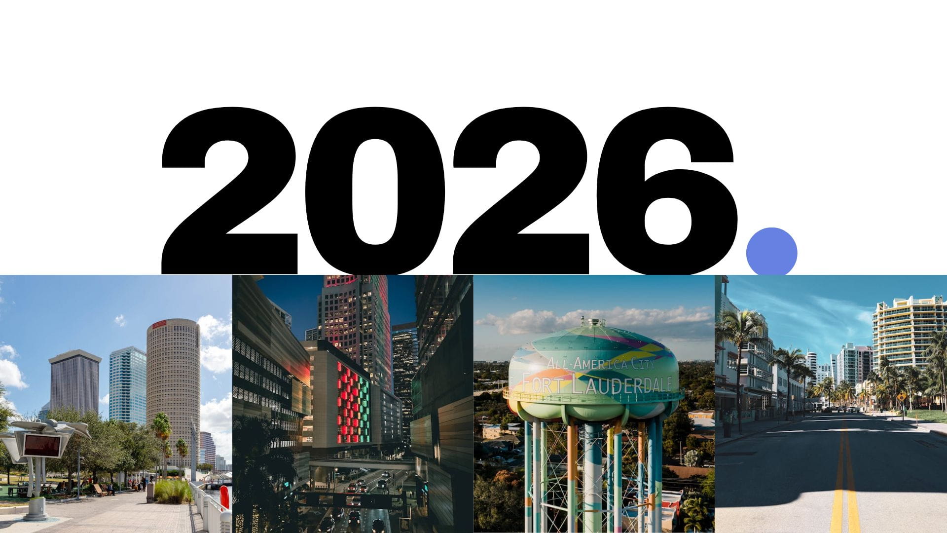
As 2026 comes into focus, Floridian Development is advancing a series of meaningful updates aimed at expanding the scope, accessibility, and functionality of the website. These changes have been in the works for some time, and are part of a broader focus to enhance the presentation of development news across the site. The goal is to make information easier to navigate, more visually engaging, and better connected across the platform, all the while maintaining the site’s focus on clear, accurate reporting.
Among the changes underway is the introduction of a new interactive development map, updated integration between articles and Floridian Advanced development pages, and long-requested accessibility features such as dark mode. Floridian Development is also working on more ambitious tools, including 3D models that will allow users to explore Miami’s future skyline through various perspectives. Additional updates and features will be rolled out throughout the year, with deeper explanations to follow as each component comes online.
Integration Improvements:
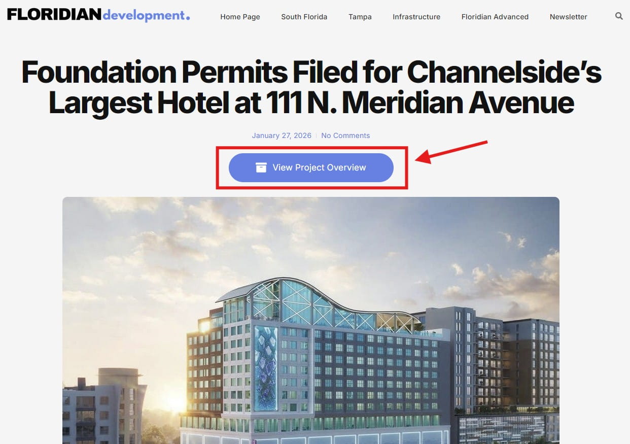
Rolled out on January 5th, this update introduces tighter integration between standard articles and Floridian Advanced pages. A new button now appears at the top of each article, allowing readers to instantly switch to a corresponding Floridian Advanced page.
These advanced pages provide a fact-checked, data-driven overview of each project, including parking counts, unit totals, building height, retail square footage, and other key information. The goal is to give readers a fast, digestible snapshot of a development without requiring them to sift through lengthy articles.
Development Map:
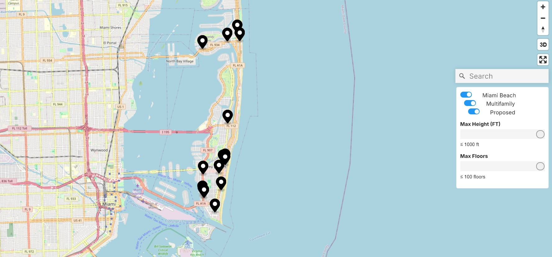
A free interactive development map has been in development for some time, focused on integrating Floridian Advanced project pages with a visual mapping interface. Once released, users will be able to filter projects using sliders for height and floor count, filter by city, development type (office, hotel, multifamily, etc.), and sort projects by phase.
The map was originally targeted for release in February 2026, but has since been delayed due to technical issues and integration challenges. Floridian Development remains committed to releasing features only when they meet usability and performance standards.
Progress updates will be shared periodically on Twitter (X).
3D Development Map:
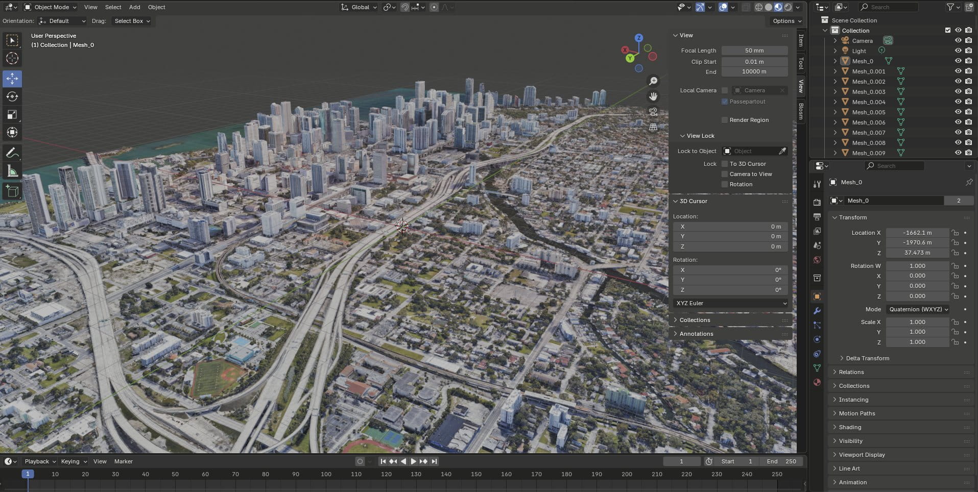
The development map currently under development is a 2D interface that displays projects as mapped points. While functional, some users have expressed interest in a more immersive 3D experience. Floridian Development has explored third-party 3D mapping providers, but due to cost and technical limitations, the platform is now evaluating the feasibility of creating 3D models.
Under this approach, users would be able to browse and filter projects using rendered images of these models, with options such as day or night views and multiple camera angles. The models would be built using Google Earth-based tools (which are permitted under existing licensing so long as the feature remains freely accessible).
Statistics Page:
Floridian Advanced has grown into Florida’s largest free database of planned and active development projects. Utilizing this existing dataset, the platform is exploring the development of a statistics page filtered by city.
This page would allow users to view metrics such as the number of residential units under construction, planned developments per municipality, and other development-related insights. All data would remain up-to-date, as Floridian Development closely tracks project updates statewide.
Updates to Floridian Advanced:
Floridian Advanced is approaching its one year anniversary and continues to evolve. One long-term initiative under consideration is the integration of official city documents directly into project pages, materials that would otherwise require immense searching through city portals.
This feature is still in the early planning stages and, if created, would not be expected until 2027 at the earliest. Documents will include all the specifics, including renderings, surveys, zoning tables, elevations, and other important information for interested parties.
Posting Schedule:
Floridian Development does not currently utilize a fixed posting schedule, though the goal is to publish approximately five articles per week, often times in the afternoon. As many readers may know (or some may not), the platform is run by a single person managing reporting, social media, website maintenance, and ongoing coding/design work for future updates.
Patience is appreciated, as the site continues to smooth out operations.
While these updates may seem extensive, Floridian Development remains committed to keeping all necessary features free. Paywalls are not planned for the foreseeable future, reinforcing the site’s mission of open access to development information, not just for industry professionals, but for the public at large.
If you have any suggestions for the website’s planned updates or suggest a new one, please let me know through the site’s email.
1 Comment
This is awesome, giving the public access to such information is so important, keep going!